Open Cosmos operates a versatile and growing constellation of Microsatellites and Nanosatellites designed to provide high-resolution insights for global challenges. The archive offering provides access to specialised hyperspectral and multispectral data, with spatial resolutions ranging from 2.5m to 5m, tailored for environmental monitoring, marine security, and sustainable resource management.
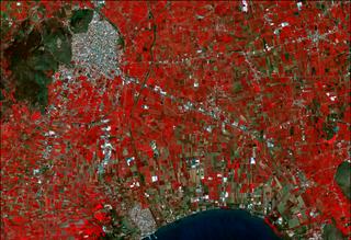
Hyper-500. High-resolution hyperspectral imagery capturing 32 narrow spectral bands at sub-5m resolution. Powered by the Hammer and Acc1 satellites, this collection is optimised for precision agriculture and yield optimisation, detailed chemical, Near real time maritime monitoring and material analysis of the Earth's surface.
Multi-500. A multispectral constellation featuring the Menut and Platero satellites. Designed for frequent monitoring and spatial planning, it offers 5m resolution with spectral bands specifically aligned to Sentinel-2 for seamless data integration.
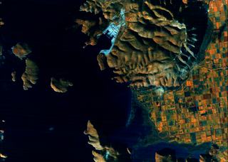
VNIR-250. Our highest-resolution multispectral product provided by the Mantis satellite. It delivers 2.5m VNIR imagery and features on-board AI processing to derive rapid, actionable insights directly from space.
Experience the power of advanced hyperspectral imaging with the Hyper-500 product line. Built upon the technical capabilities of the HAMMER (Hyperspectral AI for Marine Monitoring and Emergency Response) and Accenture-1 (SUAC) missions, this collection provides an unprecedented level of spectral detail. By capturing images across 32 narrow spectral bands, Hyper-500 enables users to identify the specific composition of objects and scenes, making it an essential tool for mitigating illegal fishing, vessel control, precision nitrogen estimation over crop fields and monitoring environmental changes near-real-time.
Environmental monitoring, energy, agriculture, and resource management.
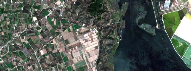
The Multi-500 product is generated by a constellation of satellites, including Platero and Menut, carrying identical or highly similar multispectral payloads. This collection is designed to support regional and global initiatives, from Catalonia's NewSpace Strategy to the sustainable farming and biodiversity goals of the SmartFood project in Andalusia participated by AGAPA (Agency for Agricultural and Fisheries Management of Andalusia). With spectral channels aligned to Sentinel-2, Multi-500 provides a high-resolution for existing monitoring workflows.

Spatial planning, climate-crisis analysis, biodiversity monitoring, and sustainable agriculture.
The VNIR-250 collection is headlined by MANTIS (Mission Agile Nanosatellite for Terrestrial Imagery Services), the first satellite launched under the ESA InCubed programme. Featuring the innovative iSIM-90 optical payload, VNIR-250 offers the highest spatial resolution in the Open Cosmos archive, delivering sharp 2.5m imagery. The mission is uniquely equipped with a high-performance, reconfigurable processing unit that exploits AI to process data on-board, reducing the time from capture to insight.
All Open Cosmos archive products are delivered in modern, GIS-ready formats to ensure ease of use:
Cloud Optimized GeoTIFF (COG).
All spectral bands and composites are delivered as COGs for efficient streaming and analysis.
L1C Processing.
Standard products include orthorectification, conversion to Top-of-Atmosphere (TOA) reflectance, and accurate geolocation using moderate resolution DEMs.
Rich Metadata.
Comprehensive STAC-compliant metadata, including photogrammetric and platform parameters, are included with every delivery.